


Record outdoor activities such as hiking, biking, running, walking, etc.
Import & Export to review, edit, share, post, download & archive.
Imported routes set to "Follow" will auto load maps for off-line navigation.
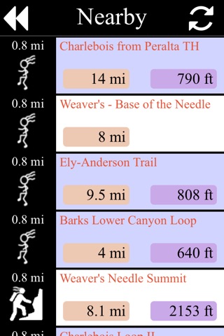
Holds up to 50 routes with multiple tracks & waypoints.
Features
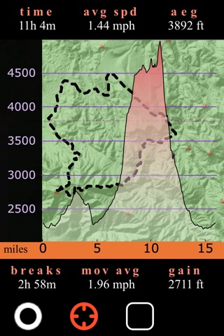
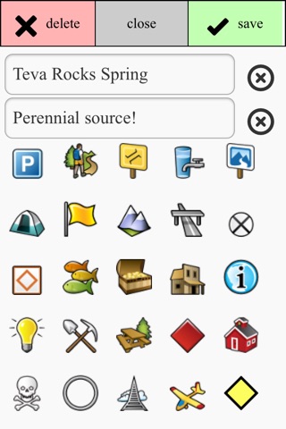
Mileage, elevation gain, accumulated elevation gain, elevation profile, adjustable splits with audio options, speed, average speed, time, moving average, compass, break calculation, waypoint creation and editing, multiple tracks on imported files. 7.5 minute (aka 1:24,000 scale) USGS Topographical and satellite layer views.
- Export is to "Route MGR". Our free on-line tool for devices larger than a phone to create, edit & store gps files. ie: gpx, gdb, kml, tcx, fit, etc...
- Extra storage must be enabled in settings for off-line maps.
- Started in Arizona, popular in the Southwest, used worldwide.
- Not recommended for multiple day trips or if your life depends on the data.
- Continued use of GPS running in the background can dramatically decrease battery life. Designed and optimized for iPhone, not iPad.